Discover Sierra Blanca: Pure Nature
There is no doubt that Marbella is a recognized tourist destination in the whole world. What is not so well known to the ordinary tourist is the amount of natural places to discover. From trails and paths with incredible views to small natural paradises that hides this pearl of the Mediterranean that is Marbella. The geographical characteristics of Marbella make it a privileged place to live in harmony with nature. The great mountain that houses the city of Marbella called “La Concha”, becomes a warm mantle for the cold winter nights. This phenomenon makes its climate an oasis in all the Spanish geography and makes its microclimate a special corner to enjoy the stay. More than one tourist has acknowledged arriving on vacation with the intention of staying less than 1 week and have decided to stay to form their life project with us. Our goal today is to show you another way to enjoy Marbella through a booming activity: hiking, with which you will know more about this destination and you will be able to enjoy incredible views and landscapes.
MARBELLA – JUANAR | VEREDA DEL FARO | RUTA DE LOS TRES VALLES
DIRECTIONS:
These 3 routes and trails start from the area known as Puerto Rico Bajo, which is very easy to find as it is in the North direction of the famous shopping center “La Cañada” in Marbella. Going up the road from Ojén (A-355) just to the left we can find the cemetery and it is in that lane where we will have to walk in the North direction to a restaurant called “La Cascada”. Just to the right of the restaurant we can see a Panel that indicates the road in North direction where one of the trails begins. We will climb about 500 meters along this road until we reach a parking lot in Puerto Rico Bajo.
MARBELLA – JUANAR
DESCRIPTION:
The path reaches a hard climb point when you arrive at what is known as “the tube”, which are the pipelines for channeling the water at birth and which consists of a large cistern at the top of the pipes. You will have to climb this road until you reach the cistern.
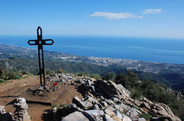
And when we get to this first climb we can see the incredible views of the coast with a blue sea and a horizon that on clear days we can see North Africa and Gibraltar. On the travertine pit there is a plateau known as Puerto Rico Alto, at this point there are the ruins of the Casa de la Finca and an abandoned plantation of fruit trees. Here is another address pole that marks the right path to Juanar.
A few meters further on is the dry bed of the birth of Puerto Rico Alto, continue north towards Juanar leaving La Vereda del Faro on the left. It continues climbing up to the next address post where the trail that goes up to the Casa del Guarda is left. We must continue to Juanar direction.
You go up a section until you find the source where the Arroyo de la Barbacana is born, better known as Arroyo de la Represa in its urban section. Once this source is passed through an area that suffered a fire and is regenerating very well.
The climb continues without stopping and the views are widening, to the left is the Pico de Juanar and the Tajo de Juan Benítez, and to the right Tajo Negro. Near the end of the climb you will find the signpost for the path that leads to Puerto de Juan Benítez.
We must continue to Juanar direction. The climb ends at the Puerto de Marbella on the slopes of Pico Juanar. Here is the last direction post that indicates the road to the right towards the viewpoint where the route ends.
VEREDA DEL FARO
DESCRIPTION:
The road becomes a lane with a chain that prevents access to vehicles. Continue along this lane and at about 300 meters there is a direction post where you have to leave the lane and turn right towards Puerto Rico Alto-Ojén. The path does not stop ascending until reaching the Hole of the Cabañiles where another steering post is located. Here you have to turn left to continue towards Puerto Rico Alto.
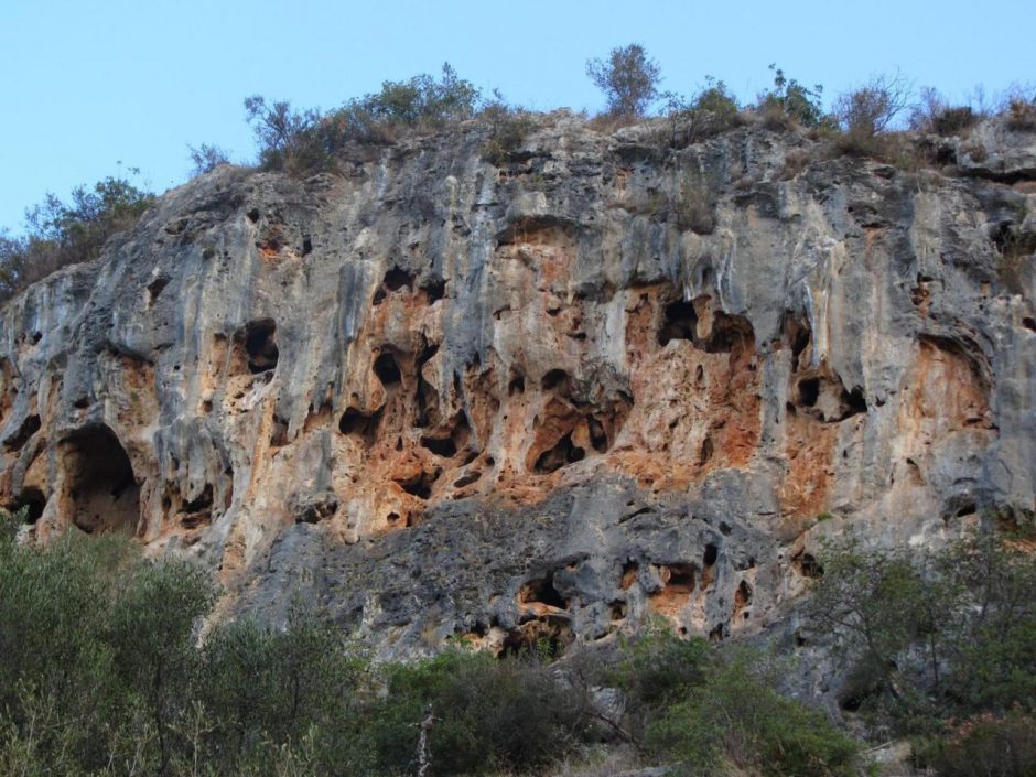
From here, continue to the left towards Puerto Rico Alto, gaining a bit of height and having unbeatable views of the Travertino Tagus. This stretch ends in the ruins of the Casa de la Finca that is next to an abandoned plantation of fruit trees. Here is another steering post and the path coincides with the climb to Juanar until, a few meters further on, you reach the dry bed of the birth of Puerto Rico Alto.
The channel only carries water when in the rainy season overflows the box that is between the bushes a few meters to the east. In this place there is a direction post indicating that you have to turn left towards Puerto las Pitas. The trail continues until crossing the stream that goes down the ravine and from there it ascends along the slope of the Loma de la Caseta until reaching the Puerto del Pino. From Puerto del Pino there are splendid views of the Cañada de la Represa with Pico del Juanar and Tajo Negro on the left, the plateau of Puerto Rico at our feet and the Valley of Puerto Rico Bajo to the south.
The trail crosses the Cañada de la Laja and climbs up the Loma del Lobo to reach the Puerto de las Pitas. In the port there is a direction post indicating that you have to turn left towards the Mirador de los Gitanos. This viewpoint is a mandatory stop to enjoy the magnificent views it offers on the coast of Marbella.
The path continues again and continues steeply down to the Hoya de las Golondrinas where another steering post is located near the Port of Santillana. Here you take the direction that indicates the Montúa. It continues down the Cañada de Santillana to the Montúa clearing where the last steering post is located and from there it goes down to the parking lot of Puerto Rico Bajo where the trail ends.
RUTA DE LOS TRES VALLES
DESCRIPTION:
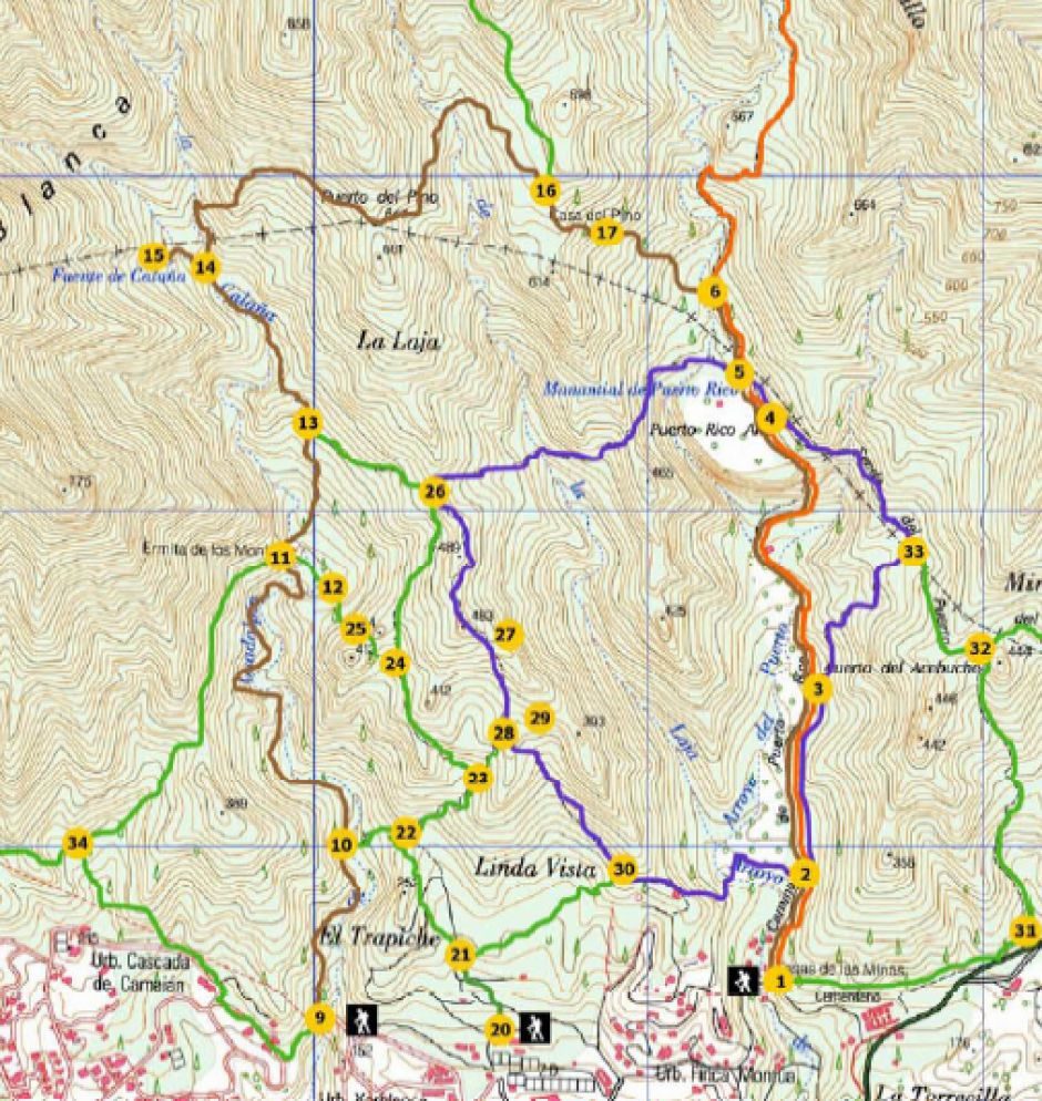
This path coincides with the ascent to Juanar until you reach the crossroads of the path that leads to the Casa del Guarda or the Pine. You have to take this path that goes to the left and goes down to the Arroyo de la Barbacana. Once you cross the stream there is a steep climb to the ruins of the Casa del Guarda.
About 150 meters past the Guardian House, the path forks in two, in the area known as the Arenal of the Casa del Guarda. Here you will find a direction post where you have to go left towards Calaña.
In this section the trail goes down to the Cañada de la Laja and then up to the Puerto de la Adelfilla, and from there, go down until you find the Arroyo de las Carihuelas where you have to turn left. The trail continues down the Arroyo de las Carihuelas until it merges with Arroyo Calaña.
At this point there is a steering post and from here you can go up to the Calaña fountain, which normally has water until the beginning of summer. You have to continue going down towards Marbella about 500 m along the same stream until you reach the left side of the Path of the Hunters. At this point you have to be careful not to continue down the stream.
Once you leave the stream you have to continue until you find the next direction post where you have to turn right towards Los Monjes. Halfway down there is another junction where you have to turn right and keep going down to the ruins of the Ermita de Los Monjes. In the ruins of the Hermitage is another address post that tells us Marbella to the south. You have to keep going down and at the end of the first hill you can see an Aleppo pine with an impressive size.
The trail continues in a slight descent crossing the stream channel several times, in these places where you have to cross it you have to be careful because it is easy to get lost. You come to a clearing where the path is very close to the stream and there is a direction sign that indicates to the left the climb that must be made to Puerto Juan Ruiz. In the port there is another direction post that indicates the way down to the plain of the Finca de Capellanía. Once on the plain you have to turn left along the path that goes up Montúa and from there go down to the parking lot of Puerto Rico Bajo where the trail ends.
CAMINO VIEJO DE ISTÁN – CANTERA
 DIRECTIONS:
To get to the beginning of this path you have to take Cánovas del Castillo avenue and at the height of Pinar de Vigil de Quiñones, go up the Calle del Pinar. After passing under the highway, go straight until you find a large roundabout.
At this roundabout take the second exit and go straight on Buchinger Avenue to another new roundabout. There you have to take the third exit and continue straight until you find the Nagüeles Park on the left. At this point you have to leave the road that borders the park and go straight on a small road that leaves the pine forest on the right.
At just 100 meters there is one of the 4 panels of the start of the trail that there is in the whole south face of Sierra Blanca and that indicates on the right the lane that goes to the Buenavista Mine.
DESCRIPTION:
From this start panel you have to continue on the road and after passing two large houses you have to turn on the first street on the left on a direction sign indicating the direction towards Istán.
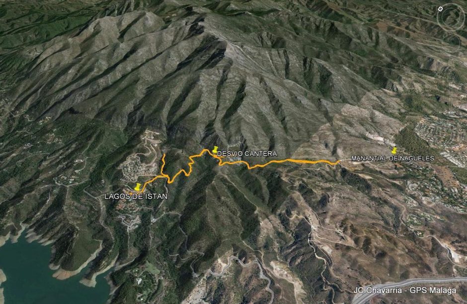
Shortly after starting the climb up the Old Road of Istán, you leave the Nagüeles Spring on the left. This section was asphalted relatively recently and during the whole journey you can see the light boxes that connect the area of Nagüeles in Marbella with the area of the Cerros del Lago in Istán.
Always keep to the right following the boundary of the Sierra Blanca Public Mount until the asphalt ends and a dirt track begins on the right. This is a good place to leave the car if you do not want to ride the previous section on asphalt.
As soon as you start the lane you go up until you find on the right a few surviving pines of the great fire that ravaged the southwestern slope of the sierra in August 1991. You continue along the lane and about 400 meters you go along the mountain to the right, from this point already has an excellent view of the Quarry of the Legua. Following the path you will come to a short and steep climb. At the end of this is reached an esplanade where the Municipal Term of Marbella ends and the Municipal Term of Istán begins.
In this esplanade you can make a stop to enjoy a splendid view of Sierra Blanca with the Pico de la Concha in its upper part, and if you walk a little to the west, also a part of the Concepción Reservoir. At the end of this esplanade there is also a patch of cork oaks that survived the fire. These trees have the particularity that they are adults although they have a young tree shape due to the stress that the fire caused when cutting their growth.
The path continues to the right up an even steeper slope until you reach the viewpoint of the Quarry of the Legua. Before reaching the viewpoint you can see some ruined towers that were the transportation system of the quarry stones that were used in the construction of the Concepción Reservoir. The quarry of the quarry has benches and tables where you can rest. From here you can continue to Istán or return along the same path to Nagüeles.
SENDA DE LOS MONJES
 DIRECTIONS:
To get to the beginning of this path you have to get to the Xarblanca school. In the north from Marbella you have to look for the bus station on Avenida del Trapiche. At the roundabout entrance and exit to the A7 which is next to the bus station, take the exit that goes north directly to Sierra Blanca.
At the next roundabout take the third exit and continue straight on the main street until find a forbidden direction in front of the Xarblanca school. If you go by car, it is advisable to park and continue on foot in the prohibited direction until you reach a road that goes to the left and that is cut by concrete blocks to prevent the passage of vehicles.
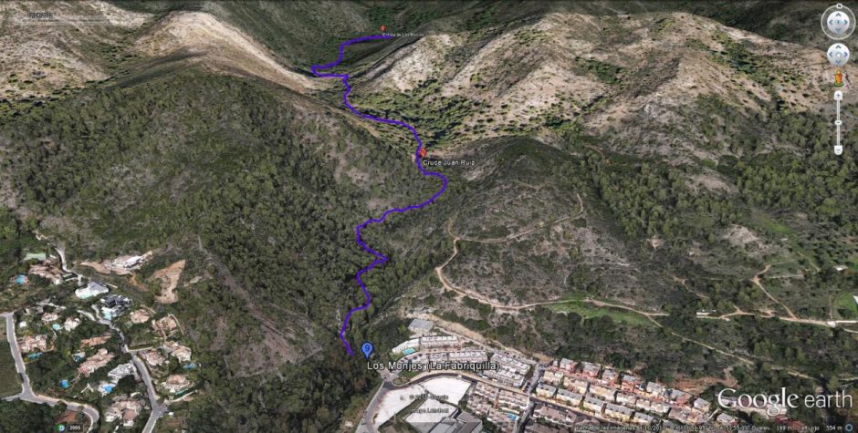
At the end of this small hill you arrive at La Fabriquilla, where you will find one of the 4 trail start panels that are found on the entire southern face of Sierra Blanca.
DESCRIPTION:
To start the path that ascends towards the north you have to cross the creek Calaña and turn right until you find a wall that apparently cuts the path. You have to go around this wall on the right side and after a few meters the path that is very marked appears again.
In this first section we will find two trails one that climbs up the slope and another that goes parallel to the stream, the two join a little later. If you choose to go down the stream you can visit some pools where it is possible to take a bath if time permits.
After leaving behind a plain with a small pine forest, continue on the left until you find a direction sign that indicates that you must continue parallel to the stream towards Los Monjes. In this section the path continues to rise little by little and obliges us to cross the riverbed several times, in these places where you have to cross it you have to be careful because it is easy to get lost.
On the last climb before reaching the ruins of the Ermita de los Monjes you can see on the left an Aleppo pine of an impressive size. Finishing the small climb you reach the landing where the remains of the Ermita de los Monjes are located. Once here you can lengthen the path if you have strength or return by the same path to La Fabriquilla.
NAGÜELES – BUENAVISTA – LOS MONJES
 DIRECTIONS:
To get to the beginning of this path you have to take Cánovas del Castillo avenue and at the height of Pinar de Vigil de Quiñones go up the Calle del Pinar, go under the highway and go straight until you find a large roundabout.
Take the second exit of this roundabout and go straight on Buchinger Avenue until you reach another new roundabout. There you have to take the third exit and continue straight until you find the Nagüeles Park on the left.
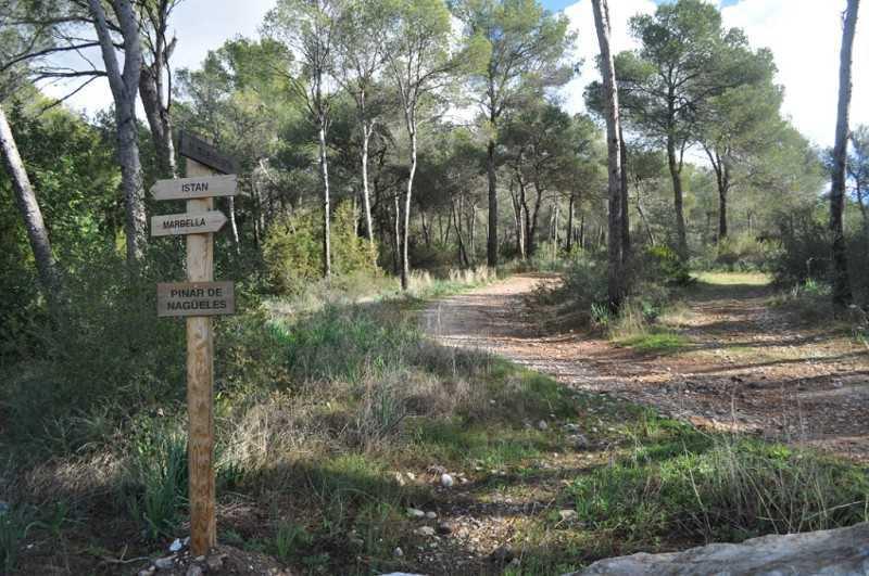
At this point you have to leave the road that borders the park and continue straight on a small road that leaves the pine forest on the right. At just 100 meters there is one of the 4 panels of the start of the trail that there is in the whole south face of Sierra Blanca and that indicates on the right the lane that goes to the Buenavista Mine.
DESCRIPTION:
The trail starts in this main lane that climbs through the pine forest and leaves other lanes left and right. When this lane begins to descend, the path ascends parallel to the Arroyo de las Piedras and, little by little, enters the Cañada de las Encinas.
At halfway up there is a signpost, from here you can go up to the Buenavista Mine, which is about 800 meters away, or continue towards Los Monjes following the path that goes off to the right and goes down until you cross the Arroyo de las Piedras. Crossing the stream the path continues until you reach a lane where you have to turn left to go up to Puerto de los Pilones.
Here is a settlement of beehives so you have to be careful not to approach the bees. Go down to the Cañada de los Pilones and then climb up to the Puerto de los Mochileros. From the port there is a quick descent to the Cañada de la Rana where another steering post is located.
You have to continue straight through the Cañada de la Janta until you reach the Puerto de Camoján, from where you can enjoy magnificent views of much of the coast. From here the path goes down to the Ermita de los Monjes. In the ruins of the Hermitage is another address post that tells us Marbella to the south.
You have to keep going down and at the end of the first hill you can see an Aleppo pine with an impressive size. The trail continues in a slight descent crossing the stream channel several times, in these places where you have to cross it you have to be careful because it is easy to get lost. You come to a clearing where the path is very close to the stream and there is a direction sign indicating that you have to keep going down to get to Marbella.
The trail continues and after passing a small pine forest we find two trails, one that ascends and another that follows near the stream, which later, the two trails, join below. If you choose to go down the stream you can visit some pools where it is possible to take a bath if time permits.
Once past the pools, continue along the path closest to the stream until you cross a step boxed and find on the left the exit of the stream by a road that ends at the Xarblanca school. As soon as you cross the stream, you will arrive at La Fabriquilla, where you will find another of the 4 trail start panels on the entire southern face of Sierra Blanca.
Sources: Medio Ambiente Ayto. Marbella, Turismo Marbella, Mujeres en las veredas.
